


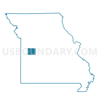
Fairview Voting District, Henry County, Missouri
About
Outline

Summary
| Unique Area Identifier | 608017 |
| Name | Fairview Voting District |
| County | Henry County |
| State | Missouri |
| Area (square miles) | 33.58 |
| Land Area (square miles) | 32.04 |
| Water Area (square miles) | 1.53 |
| % of Land Area | 95.44 |
| % of Water Area | 4.56 |
| Latitude of the Internal Point | 38.23562880 |
| Longtitude of the Internal Point | -93.80845110 |
Maps


Graphs
Select a template below for downloading or customizing gragh for Fairview Voting District, Henry County, Missouri


Neighbors
Neighoring Voting District (by Name) Neighboring Voting District on the Map
- Bearcreek / Deepwater Voting District, Henry County, MO
- Butler West Voting District, St. Clair County, MO
- Clinton Ward I, Henry County, MO
- Davis / Walker Voting District, Henry County, MO
- Monegaw Voting District, St. Clair County, MO
- Osage Voting District, Henry County, MO
Top 10 Neighboring County Subdivision (by Population) Neighboring County Subdivision on the Map
- Clinton township, Henry County, MO (8,595)
- Butler township, St. Clair County, MO (1,392)
- Fairview township, Henry County, MO (828)
- Osage township, Henry County, MO (779)
- Monegaw township, St. Clair County, MO (256)
- Davis township, Henry County, MO (241)
- Chalk Level township, St. Clair County, MO (189)
- Bear Creek township, Henry County, MO (183)
Top 10 Neighboring Place (by Population) Neighboring Place on the Map
Top 10 Neighboring Elementary School District (by Population) Neighboring Elementary School District on the Map
Top 10 Neighboring Unified School District (by Population) Neighboring Unified School District on the Map
- Clinton School District, MO (11,509)
- Lakeland R-III School District, MO (3,211)
- Appleton City R-II School District, MO (2,330)
- Montrose R-XIV School District, MO (795)